Western Neighborhoods Project is dedicated to the history of San Francisco's Richmond, Sunset, OMI and West of Twin Peaks districts.   read more ...

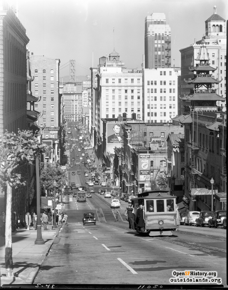
California near Stockton May 1948

View east to Bay Bridge in distance. California Street cable car, Grant Street pagoda towers, House of Lee, Cathay House, Clunie Building with Lincoln National Life ad on west side, Hotel Yolanda with Hotel Lafayette painted sign., Helvetia Hotel, Merchants Exchange, Pacific National Bank Building (18 story building at 333 Montgomery, near California, demolished 1969), Commercial Union Assurance Building (315 Montgomery). In distance, Southern Pacific Building, Fife Building with Mobilgas sign atop. [5-48 11050]
Photographer Unknown (Courtesy of a Private Collector)

California near Stockton California near Stockton

<< back to previous page

On the Map (click marker for larger map)
DOWNLOAD a watermarked copy for use on your web site.
Copyright: Responsibility for observance of copyright protections when using or copying images rests exclusively with the user. Images are provided here under Fair Use. Questions about use? Check our Permissions Page.
Citation: Please cite this image with the following:
Western Neighborhoods Project - wnp14.12198
Keywords: traffic people pedestrians transit cablecar
Neighborhoods: Chinatown

Use this form for any comments, corrections, or thoughts you have on this particular image.