Western Neighborhoods Project is dedicated to the history of San Francisco's Richmond, Sunset, OMI and West of Twin Peaks districts.   read more ...

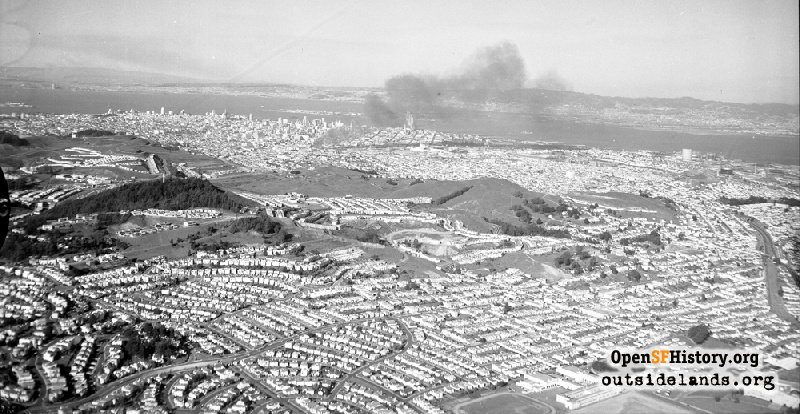
Sunnyside Aerial Mar 22, 1957

Wide Aerial northeast over Westwood Park and Sunnyside, Diamond Heights and Mt. Davidson at center. The south side of Mt. Davidson is partially developed, Diamond Heights is completely undeveloped, and development of Midtown Terrace and the south side of Twin Peaks in progress. Southern Pacific Railroad right-of-way visible on right along present-day Interstate 280. Smoke from a 3-alarm fire on Duboce between Mission and Valencia Street (the same day as a major earthquake though determined to be unrelated)
Bob Bryant (Examiner Negative Collection / Courtesy of a Private Collector)

Sunnyside Aerial Sunnyside Aerial

<< back to previous page

On the Map (click marker for larger map)
DOWNLOAD a watermarked copy for use on your web site.
Copyright: Responsibility for observance of copyright protections when using or copying images rests exclusively with the user. Images are provided here under Fair Use. Questions about use? Check our Permissions Page.
Citation: Please cite this image with the following:
Western Neighborhoods Project - wnp14.13271
Keywords: aerial fire event
Neighborhoods: Westwood Park

Use this form for any comments, corrections, or thoughts you have on this particular image.