Western Neighborhoods Project is dedicated to the history of San Francisco's Richmond, Sunset, OMI and West of Twin Peaks districts.   read more ...

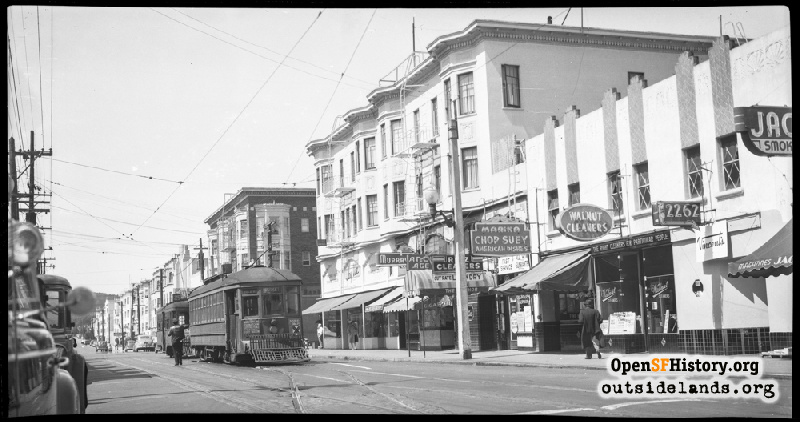
Chestnut Near Avila Apr 6, 1947

View northwest across Chestnut toward Scott St. Municipal Railway (Muni) F-line Streetcar #37 with #361 on an excursion (signed for route 25). Marina Chop Suey, Walnut Cleaners, Vincent's Cocktail Lounge, Ritz Cleaners, Anchorage Bar, McGregor's, on right. Buildings on north side of Chestnut still stand in 2023. In distance beyond Scott St., the upper part of the facade of the Presidio Theatre, then known as the El Presidio.
Photographer Unknown (Courtesy of a Private Collector)

Chestnut Near Avila Chestnut Near Avila

<< back to previous page

On the Map (click marker for larger map)
DOWNLOAD a watermarked copy for use on your web site.
Copyright: Responsibility for observance of copyright protections when using or copying images rests exclusively with the user. Images are provided here under Fair Use. Questions about use? Check our Permissions Page.
Citation: Please cite this image with the following:
Western Neighborhoods Project - wnp14.1404
Keywords: sign neon people retail stores transit
Neighborhoods: Marina

Use this form for any comments, corrections, or thoughts you have on this particular image.