Western Neighborhoods Project is dedicated to the history of San Francisco's Richmond, Sunset, OMI and West of Twin Peaks districts.   read more ...

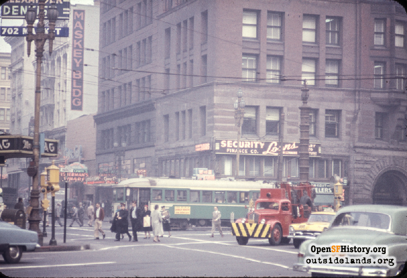
Kearny & Market Dec 14, 1956

Hazy view north across Market Street toward Kearny. Chronicle / de Young Building with Security Finance Co., W & H Cigars and Liquors, Top Hat bar. Lotta's Fountain. Maskey Building (1908) in left background was demolished in 1983 for San Francisco Federal Savings & Loan highrise project, but 4 of the 6 bays on the facade were moved, as part of the project, 2 doors east, next to the Chronicle Annex, and now face Maiden Lane. Municipal Railway (Muni) B-Line Streetcar (The B and C cars ended service on December 29, 1956). At left, signs on Flannery Building for Dr. Alexander Dentist, The Stag Bar. Birdcage traffic signals.
Photographer Unknown (Courtesy of a Private Collector)

Kearny & Market Kearny & Market

<< back to previous page

On the Map (click marker for larger map)
DOWNLOAD a watermarked copy for use on your web site.
Copyright: Responsibility for observance of copyright protections when using or copying images rests exclusively with the user. Images are provided here under Fair Use. Questions about use? Check our Permissions Page.
Citation: Please cite this image with the following:
Western Neighborhoods Project - wnp25.1318
Use this form for any comments, corrections, or thoughts you have on this particular image.