Western Neighborhoods Project is dedicated to the history of San Francisco's Richmond, Sunset, OMI and West of Twin Peaks districts.   read more ...

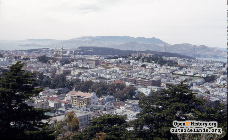
View from Buena Vista Park circa 1952

View northwest from Buena Vista Park toward Lincoln Park, Presidio, St. Ignatius Church and University of San Francisco, Lone Mountain, Golden Gate Bridge. In foreground center, Park Sanitarium and St. Agnes Church. At center, Golden Gate Park Panhandle, Lowell High School (Now the John Adams campus of City College of San Francisco). Marin Headlands, Mt. Tamalpais in distance.
Photographer Unknown (Courtesy of a Private Collector)

View from Buena Vista Park View from Buena Vista Park

<< back to previous page

On the Map (click marker for larger map)
DOWNLOAD a watermarked copy for use on your web site.
Copyright: Responsibility for observance of copyright protections when using or copying images rests exclusively with the user. Images are provided here under Fair Use. Questions about use? Check our Permissions Page.
Citation: Please cite this image with the following:
Western Neighborhoods Project - wnp25.5921
Keywords: color vista park church school bridge
Neighborhoods: Buena Vista

Use this form for any comments, corrections, or thoughts you have on this particular image.