Western Neighborhoods Project is dedicated to the history of San Francisco's Richmond, Sunset, OMI and West of Twin Peaks districts.   read more ...

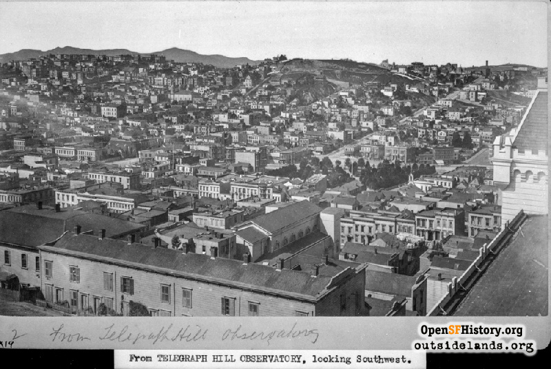
View SW from Telegraph Hill 1880s

View southwest from Layman's Castle atop Telegraph Hill toward Washington Square. Guadalupe Church (with two large steeples, completed March, 1880) at center left, Broadway near Mason. Smokestack in distance at upper right is Presidio & Ferries Railroad Union Street cable car house and power house, near Leavenworth St. Twin Peaks, Mt. Sutro and surrounding hills on horizon at upper left. [x19, 2, From Telegraph Hill Observatory, looking Southwest.]
Photographer Unknown (Courtesy of a Private Collector)

View SW from Telegraph Hill View SW from Telegraph Hill

<< back to previous page

On the Map (click marker for larger map)
DOWNLOAD a watermarked copy for use on your web site.
Copyright: Responsibility for observance of copyright protections when using or copying images rests exclusively with the user. Images are provided here under Fair Use. Questions about use? Check our Permissions Page.
Citation: Please cite this image with the following:
Western Neighborhoods Project - wnp26.347
Keywords: copy negative vista
Neighborhoods: Telegraph Hill

Use this form for any comments, corrections, or thoughts you have on this particular image.