Western Neighborhoods Project is dedicated to the history of San Francisco's Richmond, Sunset, OMI and West of Twin Peaks districts.   read more ...

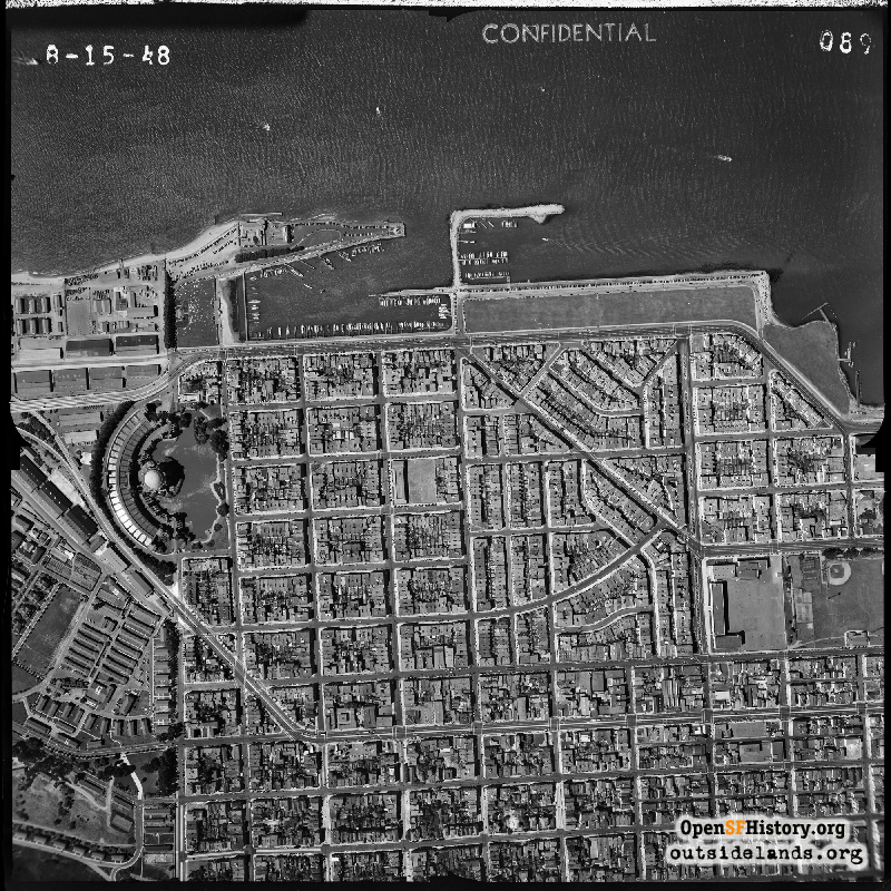
Marina Aerial Aug 15, 1948

Yacht Harbor, Palace of Fine Arts, Presidio, Marina Middle School, Moscone Playground (then Funston)(Section 089 of 190 - 1948 Aerial Survey of San Francisco) (A larger version of this image has been provided to and can be seen at the David Rumsey Map Collection)
Harrison Ryker (1948 Aerial Survey Negatives / Courtesy of Peter Linenthal, Potrero Hill Archives Project)

Marina Aerial Marina Aerial

<< back to previous page

DOWNLOAD a watermarked copy for use on your web site.
Copyright: Responsibility for observance of copyright protections when using or copying images rests exclusively with the user. Images are provided here under Fair Use. Questions about use? Check our Permissions Page.
Citation: Please cite this image with the following:
Western Neighborhoods Project - wnp31.1948.089
Keywords: aerial bay pier maritime
Neighborhoods: Cow Hollow Marina

Use this form for any comments, corrections, or thoughts you have on this particular image.