Western Neighborhoods Project is dedicated to the history of San Francisco's Richmond, Sunset, OMI and West of Twin Peaks districts.   read more ...

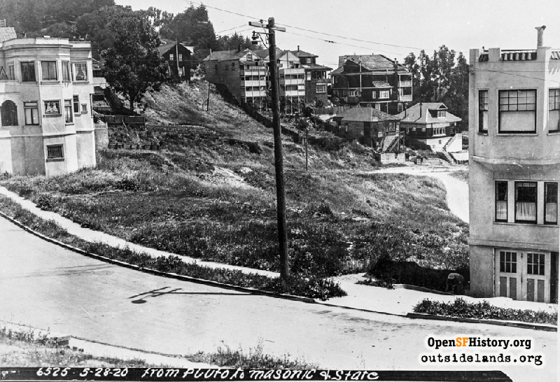
Roosevelt & Loma Vista May 28, 1920

View north from Roosevelt near Loma Vista Terrace, showing the proposed route for Roosevelt's connection to Masonic. 415 Roosevelt (then 41 Pluto) at right. 15 Loma Vista (then also on Pluto) at left. 330 Roosevelt (then 1665 Masonic), with dormer in the background right at the intersection of Levant. Pluto Street (renamed for a short time to Plato Street) to the right of this view became Roosevelt. To the left, it became Loam Vista Terrace. [From Pluto to Masonic & States dpwbook27 dpw6525]
DPW Horace Chaffee (SF Department of Public Works / Courtesy of a Private Collector)

Roosevelt & Loma Vista Roosevelt & Loma Vista

<< back to previous page

On the Map (click marker for larger map)
DOWNLOAD a watermarked copy for use on your web site.
Copyright: Responsibility for observance of copyright protections when using or copying images rests exclusively with the user. Images are provided here under Fair Use. Questions about use? Check our Permissions Page.
Citation: Please cite this image with the following:
Western Neighborhoods Project - wnp36.02308
Keywords: dpw residence construction unbuilt vista
Neighborhoods: Buena Vista

Use this form for any comments, corrections, or thoughts you have on this particular image.