Western Neighborhoods Project is dedicated to the history of San Francisco's Richmond, Sunset, OMI and West of Twin Peaks districts.   read more ...

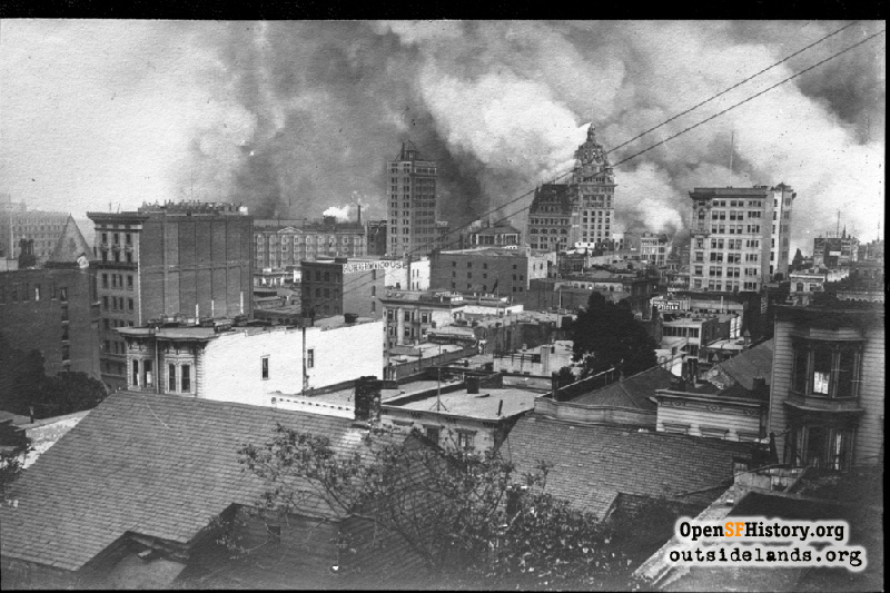
Pine near Grant Apr 1906

1906 Earthquake and Fire, elevated view southeast from Pine above Grant, of approaching fire after earthquake. Pacific States Telephone Building at left. In distance along Market St., Palace Hotel, Chronicle Annex, Hearst Examiner Building, Call Building, Mutual Savings Bank Building. Goldberg Bowen & Co., 230 Sutter, Shreve Building. Western turret of California Hotel and Theatre at far left, across from Pacific States Telephone Building.
Photographer Unknown (Marilyn Blaisdell Collection / Courtesy of a Private Collector)

Pine near Grant Pine near Grant

<< back to previous page

On the Map (click marker for larger map)
DOWNLOAD a watermarked copy for use on your web site.
Copyright: Responsibility for observance of copyright protections when using or copying images rests exclusively with the user. Images are provided here under Fair Use. Questions about use? Check our Permissions Page.
Citation: Please cite this image with the following:
Western Neighborhoods Project - wnp37.10004
Keywords: houses residence vista fire smoke ruins
Neighborhoods: Chinatown

Use this form for any comments, corrections, or thoughts you have on this particular image.