Western Neighborhoods Project is dedicated to the history of San Francisco's Richmond, Sunset, OMI and West of Twin Peaks districts.   read more ...

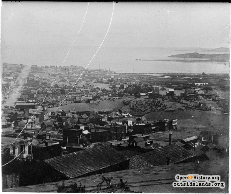
View from Nob Hill circa 1858

Part of a panoramic series by Charles Leander Weed from his home on the future Nob Hill. View southeast from about Sacramento and Taylor toward Mission Bay, 3rd street at left, in the middle of the image is the famous giant sand hill that blocked the further expansion of Market Street bet 3rd & 4th until it was cleared by David Hewes and his steam shovel during the construction of the Market Street Railroad in 1859 and 1860. Also shown is great sand hill blocking Stockton Street between O'Farrell and Geary (just in front of the right side of the Market Street hill.) .Finally, it also shows what may be the earliest known photo of Union Square Park before it was named in 1860 and fixed up. (PF)[G57 SV-013](GGNRA/Behrman GOGA 35346)
Charles Leander Weed (Martin Behrman Negative Collection / Courtesy of the Golden Gate NRA, Park Archives)

View from Nob Hill View from Nob Hill

<< back to previous page

On the Map (click marker for larger map)
DOWNLOAD a watermarked copy for use on your web site.
Copyright: Responsibility for observance of copyright protections when using or copying images rests exclusively with the user. Images are provided here under Fair Use. Questions about use? Check our Permissions Page.
Citation: Please cite this image with the following:
Western Neighborhoods Project - wnp71.0913
Keywords: vista unbuilt bay
Neighborhoods: Nob Hill

Use this form for any comments, corrections, or thoughts you have on this particular image.