Western Neighborhoods Project is dedicated to the history of San Francisco's Richmond, Sunset, OMI and West of Twin Peaks districts.   read more ...

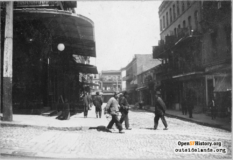
Waverly and Clay 1898

View north up Waverly Place, men walking across intersection and on sidewalk. In distance, buildings along north side of Washington Street. Cable car track on Clay street in foreground. [A street in Chinatown above Kearney San Francisco Cal.] Identical to WNP71.20052. (GGNRA/Stotler GOGA 33760)
Edwin J. Stotler (Edwin J. Stotler Photograph Collection / Courtesy of the Golden Gate NRA, Park Archives)

Waverly and Clay Waverly and Clay

<< back to previous page

On the Map (click marker for larger map)
DOWNLOAD a watermarked copy for use on your web site.
Copyright: Responsibility for observance of copyright protections when using or copying images rests exclusively with the user. Images are provided here under Fair Use. Questions about use? Check our Permissions Page.
Citation: Please cite this image with the following:
Western Neighborhoods Project - wnp71.20051
Keywords: tracks transit people poc
Neighborhoods: Chinatown

Use this form for any comments, corrections, or thoughts you have on this particular image.